


We’re all stuck in our houses and can’t really go anywhere because COVID, and a friend of mine is really missing a chance to go to Italy. Specifically, a little rental villa outside of Sorrento with a great view of the sea. I’ve seen numerous laser-cut maps, especially of lakes, and so I figured the same could be done for a coastline. This YouTube video presented a great overview; it wasn’t exactly the process I followed, since I use different software, but it informed what the workflow might look like.
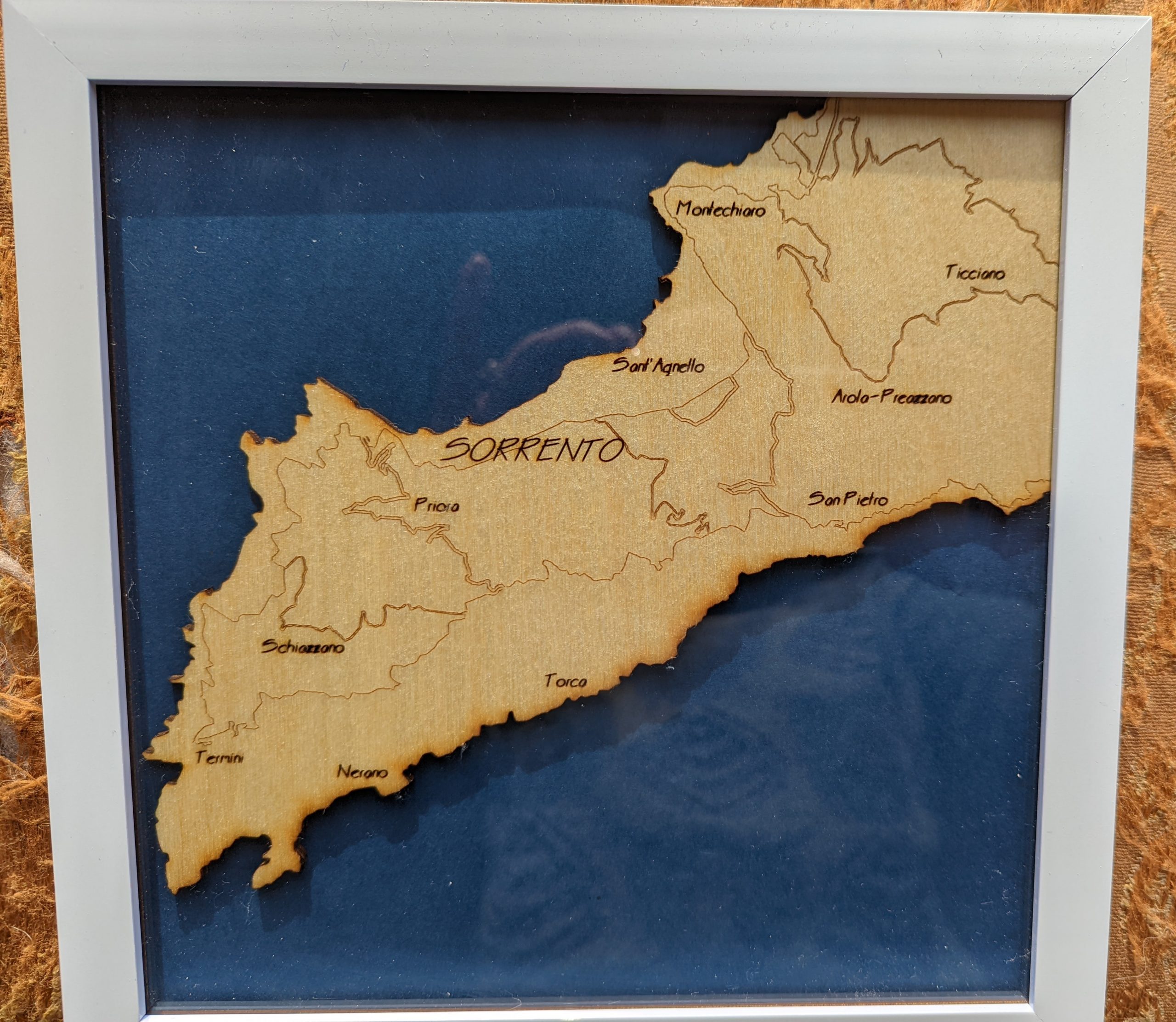
I started with a site called Snazzy Maps which allows a lot of customization of data from Google Maps. I found a view of the Sorrento area that I liked, created a Snazzy Maps style showing only water and roads, and then exported each of those as a separate image file. In Lightburn I imported each of the images as a separate layer, used the Trace Image command to convert them to a vector that the laser could handle, and then adjusted the beam settings so that the coastline was a through-cut and the roads were a light engraving. I then added place names as Font entries, configured as a beam setting in between the two. (It took a lot of little pieces of ply to get the beam settings just right.)
After sizing to a picture frame I had left over from a previous project, I cut the map into a 3mm piece of Baltic birch plywood and finished it with a light coat of wipe-on poly. I then set it in the frame above a dark blue sheet of heavy paper.
(Yes, I know there are supposed to be some islands to the south of that area, and I guess I could have cut them out separately and glued them to the paper. If I do it again I’ll remember that.)